



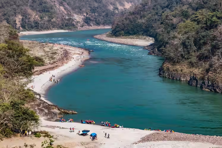
The Himalayan River Systems (Perennial Basins)
1. The Indus River System
- Origin & Course: Originates from the Bokhar Chu glacier (Tibetan plateau near Mansarovar Lake) at an elevation of 4,164m, flowing north-west between Zaskar and Ladakh ranges, entering Pakistan near Chillar in Dardistan.
- Left-Bank Tributaries: Zaskar, Suru, Kishanganga, Jhelum, Chenab, Ravi, Beas, Sutlej, and Panjnad.
- Right-Bank Tributaries: Shyok, Gilgit, Hunza, Swat, Kurram, and Gomal.
- The Five Punjab Rivers: Jhelum (originates from Verinag spring, flows through Wular Lake); Chenab (largest tributary, formed by Chandra and Bhaga streams in Lahaul-Spiti); Ravi (originates near Rohtang Pass); Beas (originates near Beas Kund, entirely within Indian territory); Sutlej (originates from Rakshastal Lake near Mansarovar, cuts through Shipki La pass).
- Indus Waters Treaty (1960): Brokered by World Bank; Western rivers (Indus, Jhelum, Chenab) allocated primarily to Pakistan with non-consumptive use rights for India; Eastern rivers (Ravi, Beas, Sutlej) allocated fully to India.
2. The Ganga River System
- Origin & Upper Course: Originates as Bhagirathi from Gangotri Glacier (Gaumukh, 3,900m). At Devprayag, Bhagirathi meets Alaknanda to form the official Ganga.
- Panch Prayag Sequence: Vishnuprayag (Dhauliganga + Alaknanda), Nandaprayag (Nandakini + Alaknanda), Karnaprayag (Pindar + Alaknanda), Rudraprayag (Mandakini + Alaknanda), and Devprayag (Bhagirathi + Alaknanda).
- Left-Bank Tributaries: Ramganga, Gomti (only major groundwater-fed plain tributary), Ghaghara (largest tributary by volume), Gandak, Kosi (notorious for shifting courses, known as ‘Sorrow of Bihar’), and Mahananda.
- Right-Bank Tributaries: Yamuna (longest tributary, originating at Yamunotri glacier, meeting Ganga at Prayagraj Triveni Sangam; joined by Chambal, Betwa, Ken) and Son (originates at Amarkantak plateau).
- Delta & Estuary: Farakka Barrage divides the flow into Padma (entering Bangladesh) and Bhagirathi-Hooghly (flowing through West Bengal to the Bay of Bengal).
3. The Brahmaputra River System
- Origin & Tibetan Stretch: Originates from Chemaungdung glacier near Mansarovar Lake, known in Tibet as Yarlung Tsangpo, flowing eastwards parallel to the Himalayas across the arid Tibetan plateau.
- Entry into India: Takes a sharp hairpin U-turn around Namcha Barwa (7,756m) and enters Arunachal Pradesh as the Siang or Dihang through the deep Dihang Gorge.
- Assam Valley Course: Joined by major left-bank tributaries (Dibang, Lohit, Burhi Dihang, Dhansiri) and right-bank tributaries (Subansiri, Kameng, Manas, Sankosh, Teesta). Near Sadiya, it is joined by Lohit and Dibang to form the massive Brahmaputra.
- Geographical Significance: Forms Majuli, the world’s largest inhabited riverine island, and suffers from severe annual bank erosion and catastrophic flooding due to high sediment load and heavy monsoon rains.
The Peninsular River Systems (Seasonal Basins)
1. East-Flowing Rivers (Drain into Bay of Bengal)
- Mahanadi Basin: Originates in Sihawa hills of Chhattisgarh, flows through Odisha, forms the Hirakud Dam (longest earthen dam), and discharges into the Bay of Bengal via a massive delta near Cuttack.
- Godavari Basin: Known as ‘Dakshin Ganga’ or ‘Vriddha Ganga’; longest river in Peninsular India (1,465 km); originates at Trimbakeshwar (Nashik, Maharashtra); major tributaries include Pravara, Indravati, Pranhita, Manjira, and Sabari.
- Krishna Basin: Second-longest east-flowing peninsular river (1,400 km); originates near Mahabaleshwar in the Western Ghats; major tributaries include Koyna, Tungabhadra, Bhima, Musi, and Ghatprabha; hosts Nagarjuna Sagar Dam.
- Cauvery Basin: Originates at Talakaveri in the Brahmagiri hills of Karnataka; sacred river with extensive delta agriculture in Tamil Nadu; major tributaries include Hemavati, Kabini, Amravati, and Bhavani; center of long-standing interstate water disputes.
2. West-Flowing Rivers (Drain into Arabian Sea)
- Narmada Basin: Flows westward through a deep tectonic rift valley between the Vindhya Range (north) and Satpura Range (south); originates at Amarkantak plateau; forms the spectacular Dhuandhar Falls near Jabalpur and a wide estuary at Bharuch; site of Sardar Sarovar Dam.
- Tapti (Tapi) Basin: Originates in Multai (Betul district, Madhya Pradesh); runs parallel to Narmada through a rift valley south of Satpura; drains into the Gulf of Khambhat near Surat.
- Other Notable West-Flowing Rivers: Sabarmati, Mahi, Luni (inland drainage in Thar desert ending in Rann of Kutch), and numerous short swift streams of the Western Ghats (Sharavati forming Jog Falls, Mandovi, Zuari in Goa, and Periyar in Kerala).
River Systems of West Bengal
West Bengal exhibits an extraordinarily complex hydrographic architecture. The state’s rivers are distinctly bifurcated into the glacier and monsoon-fed turbulent torrents of North Bengal, and the rain-fed plateau streams of the Rarh region in South Bengal, culminating in the intricate tidal estuarine network of the Sundarbans delta.
1. North Bengal Sub-Himalayan River Systems
- Teesta River: The principal river of North Bengal; originates from the Pauhunri glacier in Sikkim; flows rapidly through narrow gorges in Kalimpong and Darjeeling hills before entering the plains at Sevoke (Coronation Bridge); traverses Jalpaiguri and Cooch Behar before emptying into the Brahmaputra in Bangladesh.
- Torsa River: Originates in the Chumbi Valley of Tibet, passes through Hasimara and Cooch Behar, characterized by swift gravel-bed flows and shifting channels.
- Jaldhaka & Raidak: Originating from the Bhutan Himalayas, these rivers drain the Dooars tea garden region and are notorious for sudden flash floods during heavy monsoon spells.
- Mahananda River: Originates in the Mahaldiram hills of Darjeeling district; flows through Siliguri corridor, Uttar Dinajpur, and Malda before merging with the Ganga in Bangladesh; acts as the transitional boundary between Himalayan foothill and Gangetic plain drainage.
2. South Bengal & Rarh Plateau River Systems
- Damodar River: Historically known as the ‘Sorrow of Bengal’ due to devastating recurrent floods caused by torrential monsoon runoffs from the Chotanagpur Plateau; currently tamed by the Damodar Valley Corporation (DVC) multi-purpose dam system (Tilaiya, Maithon, Panchet reservoirs); joins the Hooghly River south of Kolkata.
- Mayurakshi River: Originates on the Chotanagpur plateau, flows through Birbhum and Murshidabad districts; regulated by the Massanjore Dam (Canada Dam), providing vital irrigation to agrarian tracts.
- Ajay River: Originates in Jharkhand, flows past Santiniketan (Bolpur) in Birbhum before merging with the Bhagirathi at Katwa.
- Kangsabati & Rupnarayan: Formed by plateau streams uniting in Bankura and Paschim Medinipur, ultimately draining into the Hooghly estuary near Geonkhali.
3. The Hooghly Estuary & Sundarbans Deltaic Network
- Bhagirathi-Hooghly Distributary: The primary western branch of the Ganga separated by the Farakka Barrage; flows past Nadia, Hooghly, Howrah, Kolkata, and Haldia before discharging into the Bay of Bengal.
- Tidal Estuaries of the Sundarbans: Unlike northern perennial streams, rivers in the southern delta (such as Matla, Saptamukhi, Raimangal, Gosaba, and Ichamati) are entirely tidal and saline, heavily influenced by diurnal oceanic tides and supporting the world’s largest mangrove ecosystem.
Some interesting facts
- Longest River in India: Ganga (2,525 km).
- Longest Peninsular River: Godavari (1,465 km).
- Largest River Basin by Catchment Area: Ganga Basin (~26% of India’s total geographical area).
- Rivers Flowing in Rift Valleys: Narmada and Tapti (flowing west into Arabian Sea).
- World’s Largest Riverine Island: Majuli, situated on the Brahmaputra River in Assam.
- Highest Dam in India: Tehri Dam (built on Bhagirathi River in Uttarakhand).
- Longest Dam in India: Hirakud Dam (built on Mahanadi River in Odisha).
- River Known as Sorrow of Bihar: Kosi River.
- River Known as Sorrow of Bengal: Damodar River.
- Farakka Barrage Purpose: To divert adequate headwater flow into the Bhagirathi-Hooghly river to flush silt and maintain navigability of Kolkata Port.
- Godavari is also known as Dakshin Ganga.
- Chambal is probably the cleanest river in India. People do not bathe in Chambal because of a story that says that anybody who touches the waters of Chambal gets cursed.
- Thamirabarani is the only perennial river in South India.
- Longest bridge in India is Bhupen Hazarika Bridge. It is built on Lohit river, a tributary of Brahmaputra. This bridge is also known as Dhola-Sadia bridge and it is 9,150 meters long. The bridge was inaugurated on 26 May 2017.
- Triveni Sangam is the place where three holy rivers, Ganga, Yamuna and Saraswati, meet. It is located in Prayag Raj, also known as the Sangam City.
- Tehri Dam on Bhagirathi river is the biggest, highest and tallest dam in India and also the eighth highest dam in the world, located at Uttarakhand.
- The Ganga and the Brahmaputra together form the largest delta in the world – the Sunderban Delta.
- The highest waterfall in India – Jog Falls is formed when Sharavathi river flows from a height of 829 ft.
- Most of the rivers in India flow from West to East direction to empty in the Bay of Bengal.
- Only a few like Narmada, Tapti and Sabarmati rivers flow from East to West direction.
- Two major rivers flowing in Rajasthan – Luni and Banas have inland water drainage, i.e., they do not empty into the ocean, but get lost in the sand.
- Yamuna is the most polluted river in India.
- Indus, Jhelum, Ravi and, Satluj are the rivers that originate in India and flow into Pakistan.
- Brahmaputra river is known as Yarlung Tsangpo in China, Dihangin Arunachal Pradesh and Jamunain Bangladesh.
- Brahmaputra is the ninth largest river in the world by discharge, and the 15th longest.
- Mahanadi used to be known as the distress of Odisha because it caused a lot of floods in the state. The situation has been brought under control by building Hirakud Dam on Mahanadi.
- Majuli is the a river island in Brahmaputra in the state of Assam. Majuli is the world’s largest river island.
- Majuli island is the first island districts in India. It was declared a district in 2016.
- Yamuna is the longest tributary in India.
- Godavari is the longest river in the Southern India.
Adhyayan Academy has just started a fresh WBCS Course titled Rishi Bankim Chandra WBCS Batch 2026. For admission in the batch, call or whatsapp @6295350330
